dføur
The collaborative GIS platform that helps you bring together planning status, data-driven analyses and participation results in one place, independently of administrative borders and without IT installation.
Collaborative Planning
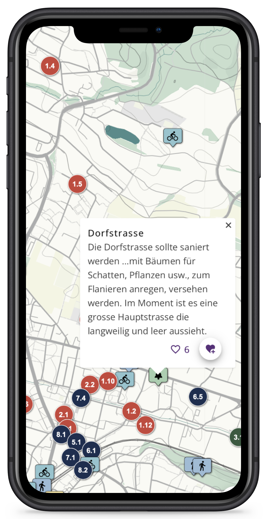
Do you want to start an informal participation process among the population or do you need to coordinate planning projects between administrative units?
Take advantage of the potential of an early needs and intentions survey. dføur enables easy and efficient participation at any point in the planning process.
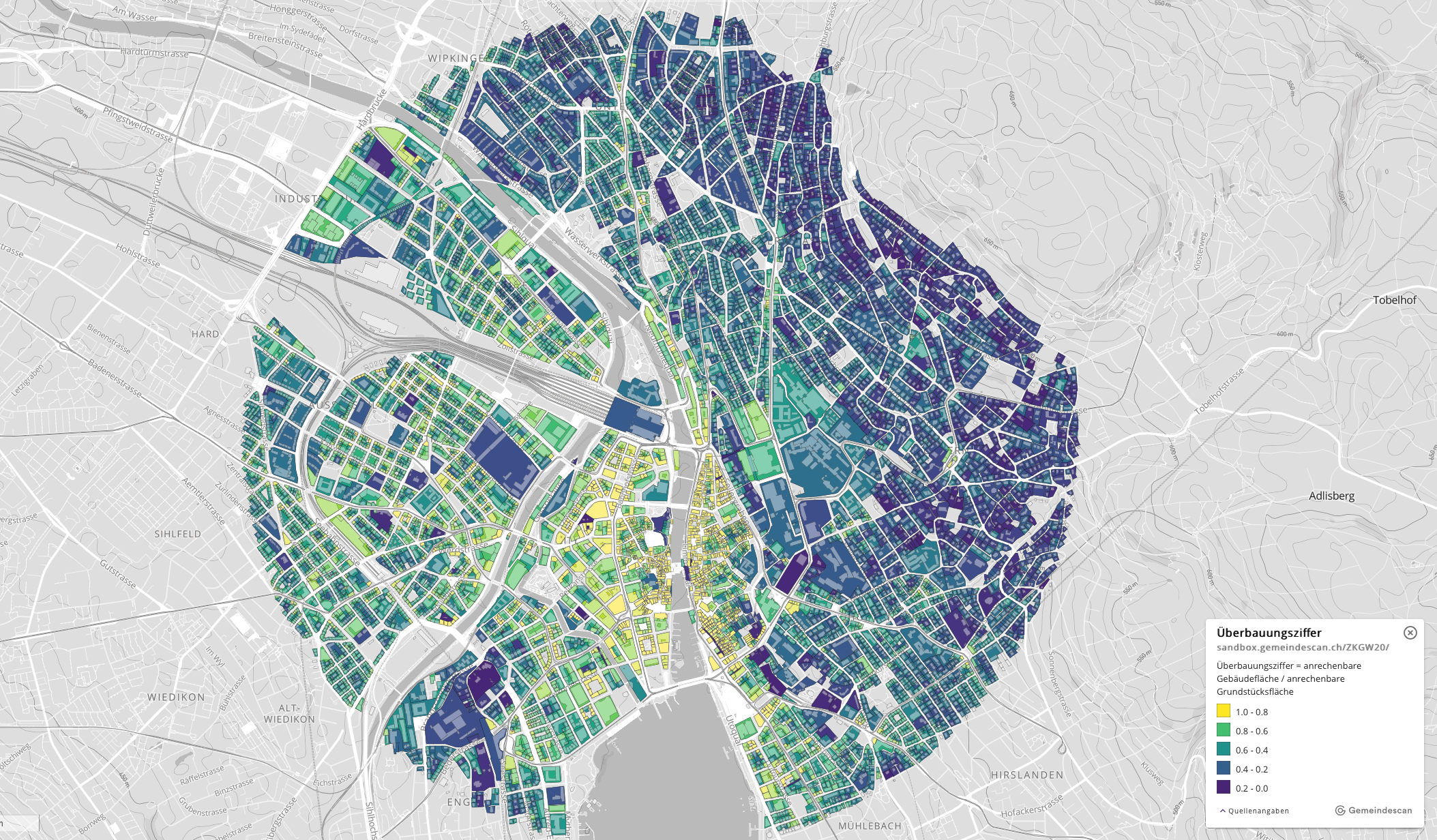
Argue with Facts
Understand how places work and verify planning projects with data-driven analyses.
Planning-specific base layers and ready made spatial data analysis for fact based decisions.
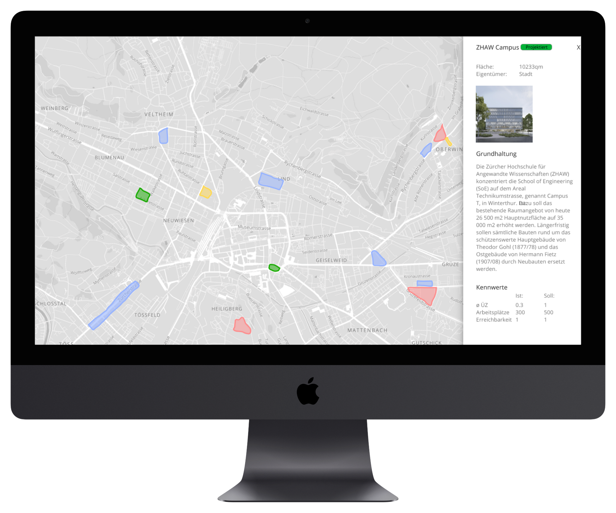
All in one Place
Projects, master plans and strategic visions immediately at hand and spatially located.
Keep track of ongoing, planned and potential projects and coordinate across departments.
Everything in one place instead of scattered in reports and plan archives. CAD plans and illustrations are imported georeferenced as PDFs and replace laborious manual assembly.