
The logistics behind school routes

In our post about safe school routes we addressed the general challenges municipalities face when it comes to allocating children to schools based on their age and address while providing, maintaining and improving the best possible infrastructure accordingly.
In Switzerland, many kids walk to kindergarden and school by themselves. For this to be possible, a range of factors are taken into consideration with the aim to provide a safe walking option for each and every kid.
The younger the age, the greater the challenge
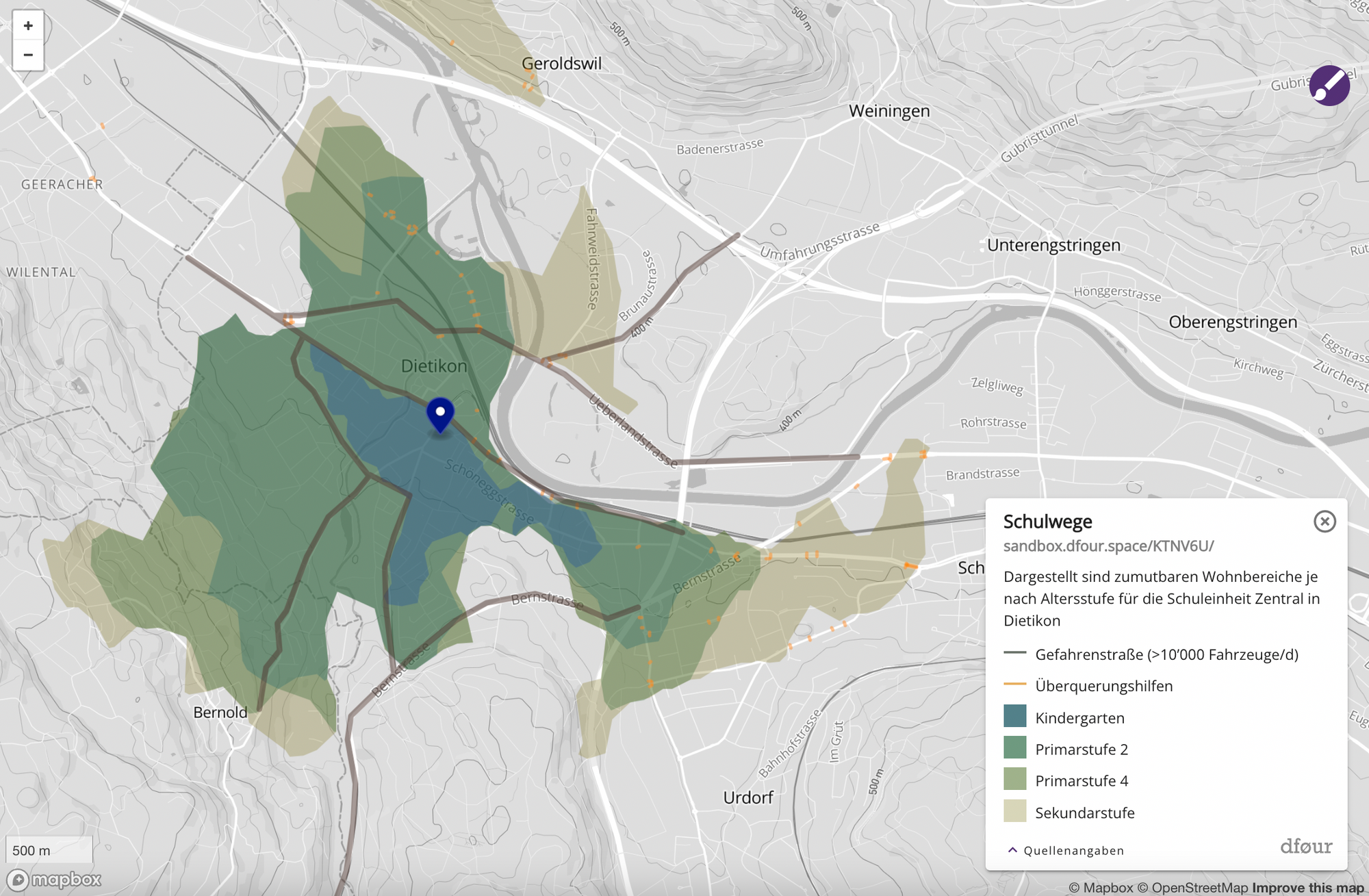
The below map shows the potential areas with safe school routes from the pin representing a central school in Dietikon. Comparing the possible catchment area for 6 year olds (blue) versus 12 year olds (light brown), and understanding the various sources of danger (e.g. roads with heavy traffic without appropriate crossing options) characterises the situation parents face upon relocation, as well as schools and local governments face upon defining school allocation.
Determining factors in the allocation process
In our project with another municipality, we optimised the routing based on a catalog of dangers drawn up for each age group in close cooperation with the local school administration.
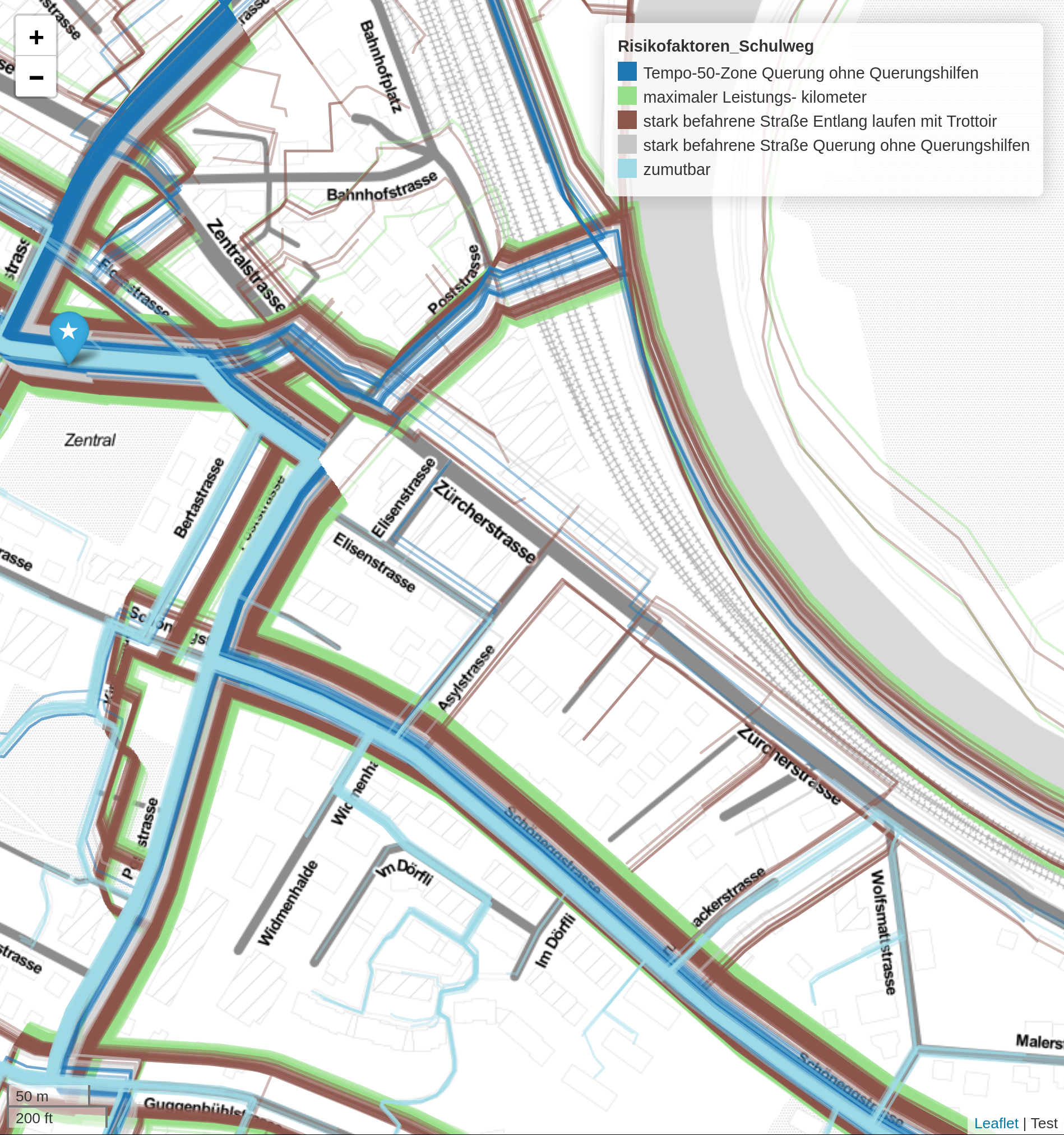
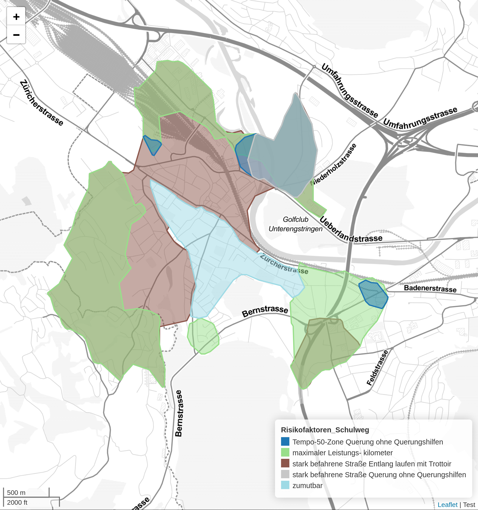
Based on 13 different security aspects, the reasonableness of an individual path between each house and the corresponding schools was determined. Those aspects were defined as a combination of
- maximum performance kilometres
- walking along and crossing roads with the zone 50 restriction or with heavy traffic
- presence of a sidewalk and/or crossing aids (e.g. central island, overpass/underpass, traffic lights)
For each age group and corresponding school grade, we calculated the safety and its safety defects for each house in combination with each school - down to the level of individual turns.
The path pass ratio
Observing all 2'967 houses in a city, we concluded the following results considering the criteria for kindergarden kids for a selected school:
- 575 houses are reasonable and meet all safety criteria
- 2'113 houses pose the danger of walking along a road with heavy traffic with a sidewalk
- 1'717 houses are located beyond the maximal performance kilometre reach
- 415 houses pose the danger of crossing a zone 50 road without crossing aids
- 305 houses pose the danger of crossing a road with heavy traffic without crossing aids
This safety-oriented school routing can be repeated worldwide as the calculation is based on OpenStreetMap combined with public state road data.